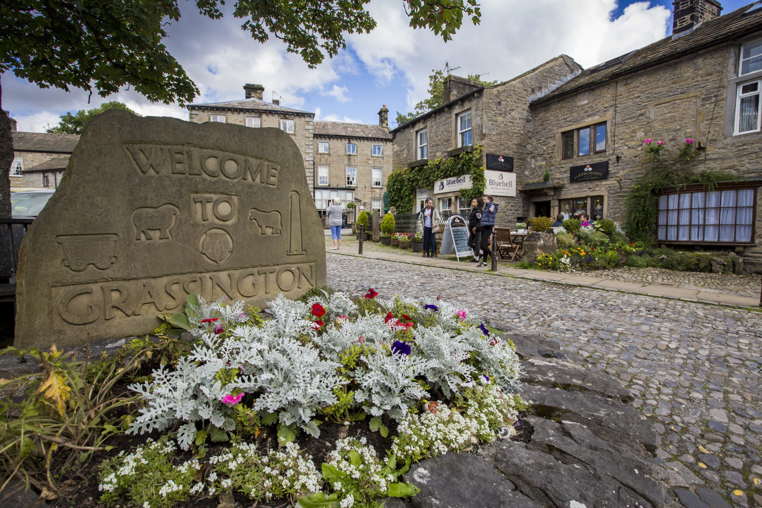
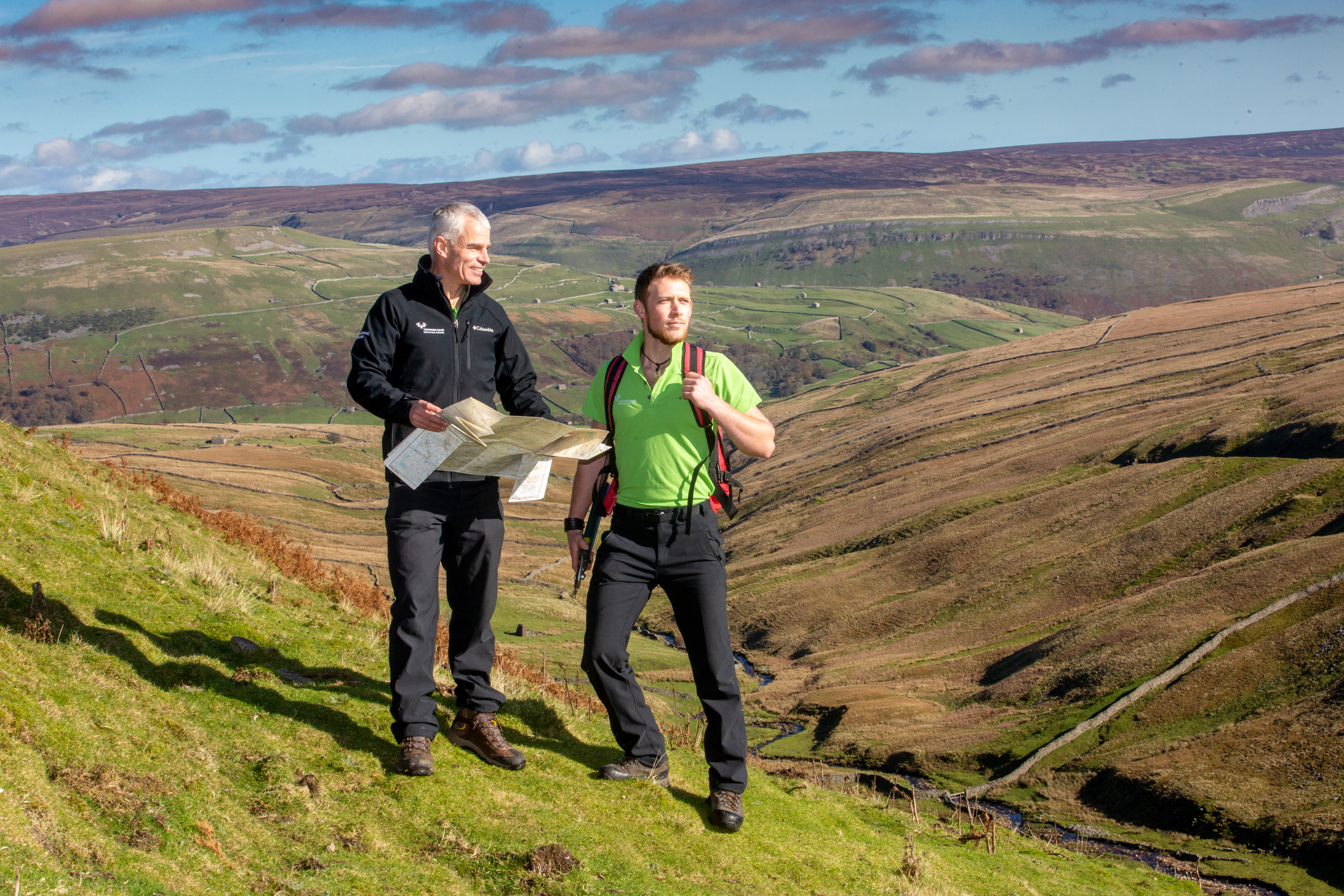
Below you will find teaching resources and guides to help you explore, understand and learn about the Yorkshire Dales National Park. Whether you're planning an educational visit, delivering classroom learning or looking for information on the area's landscapes, wildlife, heritage and communities, you'll find a range of resources to support your work.
-
This document contains an overview of the Yorkshire Dales National Park and how we manage this protected landscape. The Yorkshire Dales National Park Authority (YDNPA) works to conserve the area’s natural beauty, wildlife, and cultural heritage. This living, working landscape is home to 24,000 people across 2,179 square kilometres (841 square miles). You can explore unique limestone scenery and rare wildlife, such as red squirrels and otters, across our varied habitats. Our landscape reveals 11,000 years of human history, from ancient farming communities to industrial lead mining and stone quarrying. While tourism supports the local economy, the Authority must balance visitor needs with environmental protection and resident well-being. We help you enjoy the area through our National Park Visitor Centres, the Dales Countryside Museum, and educational outreach.
Please be aware that this summary has been generated using AI
-
This document contains an overview of the Yorkshire Dales National Park Authority (YDNPA) and our work. We protect the Yorkshire Dales National Park, which covers 2,179 square kilometres (841 square miles). Our 25 Authority Members and 150 staff help conserve the upland landscape and wildlife. We also manage more than 2,600km of public rights of way (PRoW) for you to use. Our primary duties include protecting the cultural heritage and helping you enjoy this unique environment. We work with partners and 250 volunteers to manage the National Park because 95% is privately owned. The National Park Management Plan (NPMP) guides our long-term efforts to handle challenges like climate change. We make sure that conservation comes first if there is a conflict in our goals.
Please be aware that this summary has been generated using AI
-
This document contains an overview from the Yorkshire Dales National Park Authority (YDNPA) about the Yorkshire Dales National Park. We explain how rocks formed between 541 million and 300 million years ago to shape the National Park. You can learn about the Askrigg Block, which is a granite foundation that tilts beneath the ground. The Authority describes how different areas have unique features, from limestone caves to the rounded Howgill Fells. Glaciation played a major part by carving out deep valleys and famous limestone pavements. We highlight how ice sheets 1,000 metres deep once covered almost the entire area. These natural processes created the iconic landmarks you see today, such as Malham Cove. Our guide helps you understand how the relationship between people and the land began 11,000 years ago.
Please be aware that this summary has been generated using AI
-
This document contains information on how the Yorkshire Dales National Park Authority (YDNPA) protects our local wildlife. The Yorkshire Dales National Park is home to more than 120 priority species and many rare habitats. We work to conserve natural beauty and promote the enjoyment of these special qualities. Our current Management Plan 2019–24 sets clear targets to restore landscape-scale habitats. We aim to create 450 hectares of new woodland and improve the health of our rivers. The Authority helps farmers and landowners manage important areas like hay meadows and limestone pavements. By working with partners, we protect species such as the red squirrel and black grouse. These efforts help make sure the National Park remains a thriving environment for everyone.
Please be aware that this summary has been generated using AI
-
This document contains a short history of how people have shaped the Yorkshire Dales National Park. It tracks changes from the end of the last ice age to the present day. We explain how various cultures, from nomadic hunters to Roman settlers, created the landscape you see today. Key features include Neolithic monuments, medieval field systems, and our iconic dry stone walls. The Yorkshire Dales National Park Authority (YDNPA) protects these historic features from threats like dereliction and climate change. We also help you discover this heritage through the Dales Countryside Museum and community research projects. The National Park Authority continues to research and conserve these vital resources for future generations.
Please be aware that this summary has been generated using AI
-
This document contains an overview of how farming shapes the unique landscape of the Yorkshire Dales National Park. The Yorkshire Dales National Park Authority (YDNPA) works with farmers and landowners to protect rare habitats and heritage features. We are helping local businesses move towards new schemes like Environmental Land Management (ELM) as funding rules change. Our staff provide help through the Farming in Protected Landscapes (FiPL) programme to support nature and climate projects. This work includes restoring peatlands, planting 6,000 hectares of woodland, and managing floods to keep our communities safe. We also encourage farm diversification to ensure this way of life remains a vital part of the National Park.
Please be aware that this summary has been generated using AI
-
This document contains details on how the Yorkshire Dales National Park Authority (YDNPA) manages tourism in the Yorkshire Dales National Park. We balance the needs of our local economy with the protection of our natural environment. Our work includes running National Park Visitor Centres and maintaining public rights of way for you to enjoy. In 2019, tourism supported 5,353 jobs and added £374 million to the local economy. Recent visitor surveys help us understand changing trends, including a rise in young people visiting the area. We use the National Park Management Plan 2019–24 to make the National Park a leader in sustainable tourism. This plan helps us protect Dark Skies status. We also support local businesses through high-quality development.
Please be aware that this summary has been generated using AI
-
This document contains a summary of the history, landscape, and management of Malham in the Yorkshire Dales National Park. People have shaped this area for 10,000 years, from Iron Age farmers to monks who produced wool. The Yorkshire Dales National Park Authority (YDNPA) looks after the famous limestone scenery that many of you visit. We work hard to manage the impacts of more than 100,000 annual visitors to the National Park Visitor Centre in Malham. Our Area Rangers repair eroded footpaths using local stone to keep the landscape looking natural and beautiful. High visitor numbers bring essential money to the National Park but also create challenges like traffic and rising house prices. We try to balance the needs of the environment with the well-being of the 220 people living here.
Please be aware that this summary has been generated using AI
-
This document contains details on how the Yorkshire Dales National Park Authority (YDNPA) manages visitor access and recreation. We try to balance protecting the Yorkshire Dales National Park with promoting your health and well-being. Our staff maintain more than 2,600km of public rights of way (PRoW) across 120,000 hectares of open land. We aim to help everyone enjoy the landscape through 'Access for All' and diversity projects. Sustainable tourism and better transport help the Authority reduce the impact of cars on the National Park. Our Rangers work with land managers to repair paths and make sure routes are easy to use. By working with you, we make sure the National Park remains a welcoming place for everyone.
Please be aware that this summary has been generated using AI
-
This document contains an overview of the quarrying industry within the Yorkshire Dales National Park. We explain how this historic industry provides vital materials and jobs for our local communities. The Yorkshire Dales National Park Authority (YDNPA) manages these sites through the planning process. We work with operators to reduce noise and traffic while protecting our unique landscape and wildlife. The National Park Authority encourages using rail transport at quarries such as Swinden and Horton. You can learn about how we make sure that companies restore land for nature and public access. Our policies in the Local Plan help us balance economic needs with environmental conservation.
Please be aware that this summary has been generated using AI
Visiting Malham
During the summer months Malham is very busy with school groups. Please consider visiting other sites in the Yorkshire Dales to reduce the impact on Malham, such as Clapham.
-
This document contains a landscape map of the Malham area within the Yorkshire Dales National Park. The Yorkshire Dales National Park Authority (YDNPA) provides this detailed 1:25,000 scale resource to help you plan your visit. You can easily find famous landmarks like Malham Cove, Gordale Scar, and Janet's Foss. The map also shows settlements, public rights of way (PRoW), and historic field systems across the National Park. We want to make sure you enjoy exploring the outdoors safely and responsibly. Please use this guide to discover the unique features that the National Park Authority protects.
Please be aware that this summary has been generated using AI
-
This document contains a detailed map of Malham within the Yorkshire Dales National Park. The Yorkshire Dales National Park Authority (YDNPA) provides this map at a scale of 1:2,500 to help you. It shows local features like Malham Beck, various footpaths, and the National Park Visitor Centre. You can see the locations of many houses, hotels, and farm buildings across the village. We provide these maps to make sure you enjoy your visit to the National Park.
Please be aware that this summary has been generated using AI
-
This document contains an educational guide created by the Yorkshire Dales National Park Authority (YDNPA). It explains the geological history of the Yorkshire Dales National Park over more than 400 million years. We describe how tropical seas and moving glaciers shaped famous landmarks like Malham Cove and Gordale Scar. You can learn about the formation of limestone pavements and the unique fossil-rich reef knolls. The guide also highlights human history, from Bronze Age burial mounds to stone barns built in the 1700s. We want to help you discover how natural forces carved this world-famous landscape.
Please be aware that this summary has been generated using AI
-
This document contains details from the Yorkshire Dales National Park Authority (YDNPA) for visiting the Yorkshire Dales National Park. We provide four color-coded routes starting from the Malham National Park Visitor Centre. You can walk 1.6km (1 mile) to Malham Cove or visit Gordale Scar and Janet’s Foss. To help us look after the National Park, please keep dogs on leads near sheep. We ask you to stay on public rights of way and take your litter home. Please stay water aware and leave gates as you find them to respect local communities.
Please be aware that this summary has been generated using AI
-
Activities to do with groups in Malham
Visiting Aysgarth Falls and Freeholders Wood
-
This document contains a map of the Aysgarth area within the Yorkshire Dales National Park. The Yorkshire Dales National Park Authority (YDNPA) provides this 1:25,000 scale map for you. We show local features like Wensleydale, the Aysgarth Falls, and villages such as Redmire. You can find public rights of way (PRoW), parking, and toilets on the National Park map. The map uses 2022 Ordnance Survey information and remains the property of the Authority.
Please be aware that this summary has been generated using AI
-
This document contains a map and guides for four walks near Aysgarth in the Yorkshire Dales National Park. The Yorkshire Dales National Park Authority (YDNPA) offers routes ranging from 0.8km (1/2 mile) to 4.3km (2.7 miles). You can explore the falls and ancient woods starting from the National Park Visitor Centre. We want you to enjoy your visit while following the 'Countryside Code'. Please keep dogs on a lead to protect livestock and take your litter home. You should also stay water aware as rivers in the National Park can be deep and cold. These simple rules help us protect the land and the local community.
Please be aware that this summary has been generated using AI
-
This document contains a comprehensive guide for teachers and group leaders visiting Aysgarth Falls and Freeholders Wood. We provide details for a 1.5km (1 mile) woodland trail that begins at Aysgarth Falls National Park Centre. You will find information about the geology of the Yorkshire Dales National Park and its dramatic waterfalls. The Yorkshire Dales National Park Authority (YDNPA) bought Freeholders Wood in 1982 to help protect this site. We manage the area using traditional coppicing to make sure a wide range of wildlife can thrive. The pack includes worksheets for students to learn about the landscape and the history of local tourism. It explains how the Authority maintains paths so you can explore the National Park safely.
Please be aware that this summary has been generated using AI
-
Activities to do with groups at Aysgarth Falls
Visiting Grassington and Hebden
-
This document contains a 1:25,000 scale map of Grassington and Hebden within the Yorkshire Dales National Park. The Yorkshire Dales National Park Authority (YDNPA) provides this resource to help you plan your visit. It shows villages such as Threshfield and Linton alongside woodland and the River Wharfe. We include public rights of way (PRoW) and historical sites to improve your experience in the National Park. The Authority wants to make sure you have the best information to explore our landscape.
Please be aware that this summary has been generated using AI
-
This document contains a detailed map of Grassington village within the Yorkshire Dales National Park. The Yorkshire Dales National Park Authority (YDNPA) created this 1:5,000 scale map to help you explore the area. It shows key locations including the National Park Visitor Centre, car parks, and the River Wharfe. We also highlight important landmarks like Linton Falls, the recreation ground, and several public facilities. You can use this resource to navigate the streets and find your way to nearby walking paths.
Please be aware that this summary has been generated using AI
-
This document contains a route guide for a 7.5km (4.5 miles) circular walk through the Yorkshire Dales National Park. We at the Yorkshire Dales National Park Authority (YDNPA) invite you to visit beautiful spots like Linton Falls. This moderate walk takes at least two hours and involves a significant climb into ancient woodland. You can enjoy spring wildflowers and spot birds like woodpeckers and dippers along the river. The path also leads you past an Iron Age settlement before returning to Grassington. We provide parking and toilets at the Grassington National Park Visitor Centre. Make sure you wear sturdy boots as some paths in the National Park are rocky.
Please be aware that this summary has been generated using AI
-
This document contains a guide for a 5.5km (3.5 miles) circular walk through the meadows of the Yorkshire Dales National Park. The Yorkshire Dales National Park Authority (YDNPA) provides directions from the Grassington National Park Visitor Centre to local historic sites. This route takes at least 90 minutes and includes views of Barden Moor and the spectacular Linton Falls. We have included details about local parking, public transport, and refreshments in Grassington to make your trip easy. We hope you enjoy exploring these riverside paths and the 12th-century Linton Church within the National Park.
Please be aware that this summary has been generated using AI
-
This document contains a map of a circular walking trail within the Yorkshire Dales National Park. The Yorkshire Dales National Park Authority (YDNPA) invites you to start your walk at the National Park Visitor Centre in Grassington. We have marked 15 stopping points along this scenic route for you to enjoy. You will pass through historic areas like Grass Wood and see lead rakes or prehistoric earthworks. The Authority provides this map to help you navigate through Lea Green and Bastow Wood safely. Please make sure you follow the marked path to protect the Environmental Stewardship Scheme areas. This route covers approximately 5km (3 miles) of beautiful landscape.
Please be aware that this summary has been generated using AI
-
Activities to do with groups in Grassington
Visiting Clapham
-
This document contains a guide to help you plan group activities in Clapham within the Yorkshire Dales National Park. The Yorkshire Dales National Park Authority (YDNPA) provides these resources for learning in the National Park. You can explore the nature trail or visit a show cave to study geography and geology. We suggest locations for stream dipping and river studies to help with your science projects. Students can also investigate the impact of tourism or view scenery at Gaping Gill. Glaciers moved more than 100 sandstone boulders to the Norber Erratics over 12,000 years ago. You can discover local history on a heritage walk past Ingleborough Hall and ancient field systems.
Please be aware that this summary has been generated using AI
-
This document contains a detailed map of the Clapham area produced at a 1:10,000 scale. The Yorkshire Dales National Park Authority (YDNPA) compiled this geographical data on 29 July 2024. We have created it to help you explore the village and its landscape within the Yorkshire Dales National Park. The map shows important features such as Clapham Beck, The Lake, and many public rights of way (PRoW). You can also find various landmarks like Clapdale Scars and several caves north of the village. We hope this map helps you to enjoy your visit to this part of the National Park.
Please be aware that this summary has been generated using AI
-
This document contains guidance for group leaders planning river studies within the Yorkshire Dales National Park. The Yorkshire Dales National Park Authority (YDNPA) suggests three specific sites for measuring river discharge and bed load. You can park at the National Park Car Park and walk 2.5km (1.5 miles) to reach the sites. We ask that you work from upstream sites downwards to help with biosecurity in the National Park. Please contact the Ingleborough Estate before you visit to book your group and pay the entry fee. Your students can also examine how man-made features like the local pumping station impact their river data.
Please be aware that this summary has been generated using AI
-
This document contains a 1:25,000 scale map of Clapham and Ingleborough in the Yorkshire Dales National Park. The Yorkshire Dales National Park Authority (YDNPA) provides this guide to help you find local landmarks and trails. We highlight features like Ingleborough Cave, Gaping Gill, and the limestone pavements near Moughton and Norber. You can follow public rights of way (PRoW) like the Pennine Bridleway and various 'green lanes'. Our staff updated this map on 4 June 2024 to make sure you have accurate details for your visit.
Please be aware that this summary has been generated using AI
-
This document contains a geological sketch showing rock layers around Clapham in the Yorkshire Dales National Park. We at the Yorkshire Dales National Park Authority (YDNPA) want to help you understand our landscape. The diagram follows a 2km (1.2 miles) route from Ingleborough summit down to the village. It identifies several rock types including Millstone Grit, the Yoredale Series, and limestone. You can also see the locations of Gaping Gill, Ingleborough Cave, and the Craven faults. These features help define the unique character of the National Park.
Please be aware that this summary has been generated using AI
-
This document contains a detailed map showing the area around Clapham and Ingleborough Cave in the Yorkshire Dales National Park. The Yorkshire Dales National Park Authority (YDNPA) created this map at a scale of 1:5,000. It highlights local features like Clapdale Wood, Clapdale Barn, and the path of Clapham Beck. You can see various caves, tracks, and footbridges marked across the landscape of the National Park. We compiled this information on 29 July 2024 to help you understand this specific location.
Please be aware that this summary has been generated using AI
Planning a group visit?
Visit our dedicated page for resources to support the planning of your visit.
Planning an independent visit?
Have a look at our ‘In the Dales’ guides to support you in planning your own visit with a group, get inspiration for places to visit and things to do there:
-
This document contains information about accessibility in the Yorkshire Dales National Park, including accessible toilets, Changing Places facilities and short Miles Without Stiles routes. It explains where you can hire all-terrain wheelchairs and Trampers, and offers guidance on prayer outdoors, public transport and information in Hindi, Urdu and Mandarin. It also provides links to further guidance and invites feedback about support for visiting.
Please be aware that this summary has been generated using AI
-
This document contains a guide to visiting Aysgarth Falls in the Yorkshire Dales National Park, including information about the visitor centre, public transport, walks and nearby attractions. It also suggests nature activities, places to eat and advice for following the Countryside Code.
Please be aware that this summary has been generated using AI
-
This document contains a guide to Clapham in Yorkshire Dales National Park, including public transport, walks, nearby attractions, shops and cafés. It also suggests nature activities and provides advice from the Countryside Code to help visitors enjoy the outdoors and protect the natural environment.
Please be aware that this summary has been generated using AI
-
This document contains a guide to Grassington, including the National Park Visitor Centre, public transport, walks and nearby places to visit. It also suggests nature activities, local shops and cafés, and gives advice on following the Countryside Code, respecting others and protecting the natural environment.
Please be aware that this summary has been generated using AI
-
This document contains a guide to visiting Hawes in the Yorkshire Dales National Park, including walks, public transport, local attractions, shops and cafés. It highlights nature activities, nearby places to visit such as the Dales Countryside Museum and Snaizeholme Red Squirrel Trail, and advice from the Countryside Code.
Please be aware that this summary has been generated using AI
-
This document contains a guide to visiting Malham in the Yorkshire Dales National Park, including public transport, walks, cafés, nature activities and local resources. It also explains how to follow the Countryside Code, with advice on respecting others, protecting the environment and enjoying the outdoors safely.
Please be aware that this summary has been generated using AI
-
This document contains a guide to visiting Ribblehead in the Yorkshire Dales National Park, with public transport information, walks, nearby places to visit, cafés and nature activities. It also includes advice on preparing for walks, enjoying the countryside responsibly and following the Countryside Code.
Please be aware that this summary has been generated using AI
-
This document contains nature connection activities from the Yorkshire Dales National Park Authority (YDNPA), helping people notice and explore nature through their senses. Activities include sound maps, meeting a tree, nature portraits, drawing, sensory walks and finding small natural treasures.
Please be aware that this summary has been generated using AI
-
This document contains an introduction to the Yorkshire Dales National Park, explaining what national parks are and the role of their authorities. It covers the National Park’s history, size, communities, landscapes, wildlife, activities, attractions and walking routes, with a map and links to further information.
Please be aware that this summary has been generated using AI
Teaching resources
The National Parks UK website offers a range of resources on National Parks, including a map, facts and figures and a KS2 National Park Curriculum.
Green Careers
Great Places - YDNPA Compilation Film
Careers with the Yorkshire Dales National Park Authority: Teaching Pack
-
This document contains an introduction to the career opportunities we offer at the Yorkshire Dales National Park Authority (YDNPA). We created a new toolkit for teachers and young people to explore roles within the Yorkshire Dales National Park. The Authority employs 151 people in roles ranging from conservation and planning to finance and human resources. We support you to live and work in the National Park through training and our youth forum. Our toolkit, developed with The Edge Foundation, provides lesson ideas and career stories for young people. You can download these resources online to help you plan your career.
Please be aware that this summary has been generated using AI
-
This document contains stories from six people who work at the Yorkshire Dales National Park Authority (YDNPA). We offer many different roles within the Yorkshire Dales National Park, including an Apprentice Ranger and Planning Assistant. Many staff members used apprenticeships to start their careers and gain important professional skills. We provide flexible working to help you balance your family life or other business interests. Our teams help farmers to conserve habitats and work with businesses to help the local economy grow. You will see how we maintain public rights of way (PRoW) and protect the cultural heritage of the National Park. These stories show that you can find a rewarding and professional career while living in this beautiful area.
Please be aware that this summary has been generated using AI
-
This document contains a careers toolkit we created to help you teach pupils about the world of work. We use the Yorkshire Dales National Park Authority (YDNPA) as a case study for Key Stage three and four pupils. This seven-lesson scheme helps young people identify their strengths through activities like personal 'SWOT' analyses. Pupils will investigate diverse job roles and business culture within the Yorkshire Dales National Park. The project meets Gatsby Benchmarks and focuses on developing soft skills like teamwork and clear communication. We provide resource sheets to help you guide students as they prepare and deliver final presentations. This work helps pupils reflect on their goals and understand the local labour market in the National Park.
Please be aware that this summary has been generated using AI
-
Future career and project-based learning PowerPoint
-
This document contains resource sheets to help you explore careers with the Yorkshire Dales National Park Authority (YDNPA). We designed these lessons to help you think about your career goals and your own starting point. You will carry out a SWOT analysis to find your strengths and any areas for development. The project asks you to investigate one of the three directorates within the National Park Authority. You will also learn the difference between the Yorkshire Dales National Park and the Authority. We provide tips on how to deliver a presentation and how to develop your soft skills. These activities help you understand our work culture and the many roles our staff perform across the National Park.
Please be aware that this summary has been generated using AI
Additional links
- BBC Bitesize (opens in new tab)
- Countryside Classroom (opens in new tab)
- Dales Rocks (opens in new tab)
- Forestry England (opens in new tab)
- Learning outside the classroom (opens in new tab)
- Out of oblivion (opens in new tab)
- The Field Studies Council (opens in new tab)
- The Wildlife Trust (opens in new tab)
- The Woodland Trust (opens in new tab)
- Yorkshire Peat Partnership (opens in new tab)
- Wildlife Information (opens in new tab)
- Woodland Classroom (opens in new tab)
Can't find what you need?
If you have any questions or need additional information, please get in touch with the Learning and Engagement Team.