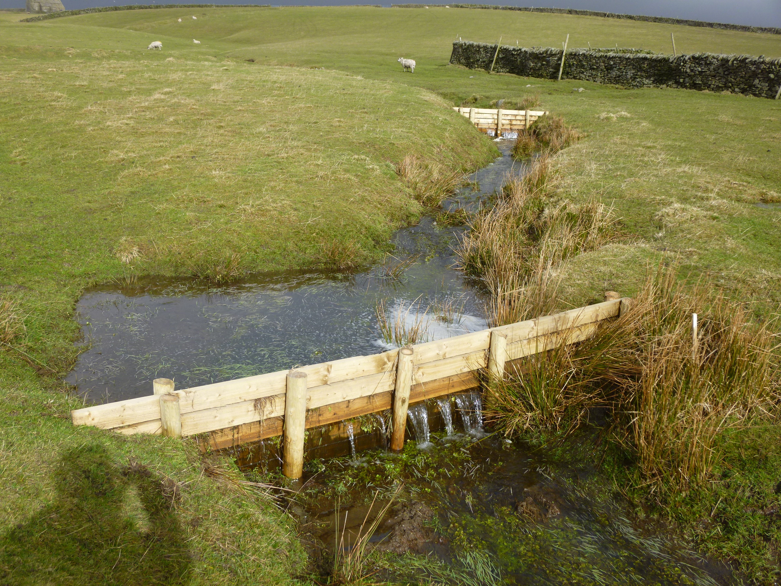
Leaky dam. © Yorkshire Farming Wildlife Partnership
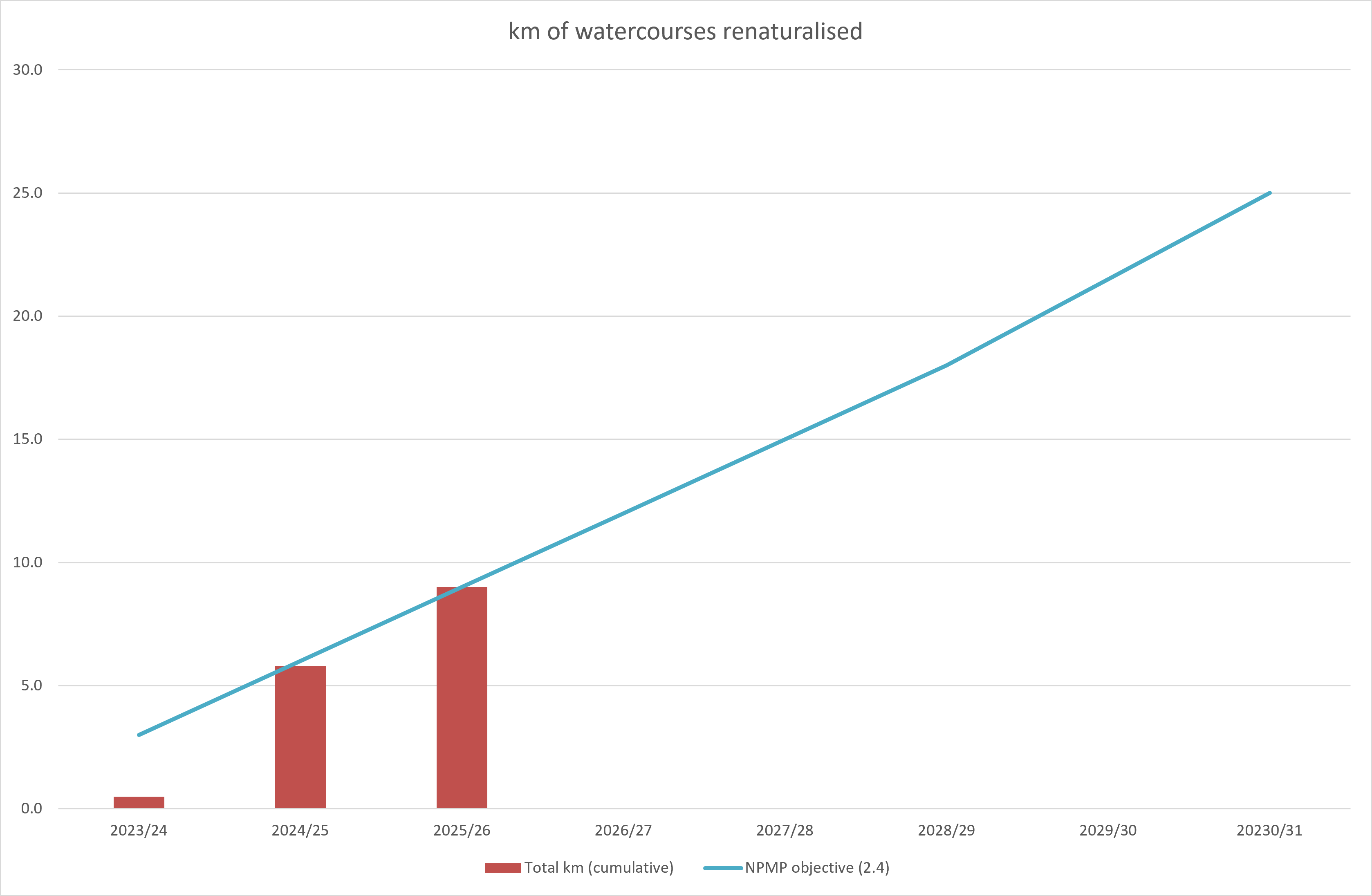
Objective 2.4
Some progress
Significantly increase take up of natural flood management measures to reduce flood risks inside and outside the National Park, including ‘re-naturalising’ 25km of watercourses by 2030.
Progress
Rationale
In recent years, rivers that rise in the National Park have contributed to serious flooding incidents in towns and cities across the north of England, including Lancaster, Carlisle and York. Alongside planting new woodland (see 2.3) and restoring artificially-drained peatland (2.2), there is robust evidence that other natural flood management measures – like reducing soil compaction, installing ‘leaky dams’, or creating ponds and scrapes – can help to reduce downstream flood peaks without disruption to farming operations. The OuseWem project is already bringing innovative solutions to flood and water environment management in the Upper Swale and Ure. Creating more natural and functional floodplains – for example by removing artificial flood banks – can also help to slow the flow of water downstream, as well as creating valuable wetland habitats that can help reduce the impact of more extreme weather events (floods and drought) associated with climate change The Nature Recovery Plan for the Yorkshire Dales National Park envisages restoring 100 km of river by 2040.
Lead organisations
Environment Agency
Supporting organisations
Yorkshire Dales Rivers Trust; Lune Rivers Trust; Eden Rivers Trust; Dales Farmer Network; Aire Rivers Trust; Ribble Rivers Trust; Leeds City Council; Natural England; National Trust; Yorkshire Dales National Park Authority, North Yorkshire Council; York City Council; Wild Trout Trust.
Cost over 5 years
Funding shortfall